 |
Snowshoe
is the name of an unincorporated area and also a ski resort, located in the Allegheny Mountains of Pocohontas County in east-central West Virginia. The ski resort is situated in the bowl shaped convergence of two mountains, Cheat and Back Allegheny, at the head of the Shavers Fork of the Cheat River. Snowshoe is home to the second highest point in West Virginia and the peak elevation for Cheat Mountain at Thorny Flat reaches 4,848 feet above sea level. The Village at Snowshoe is located at the summit of the mountain, rather than at the base, as is typical of many ski resorts. Snowshoe Mountain is the name of the resort - not the name of the mountain. The resort covers 244 acres and although it's best known for its' wintertime activities, it also has extensive mountain biking trails, a golf course and horseback riding trails. The spring, summer and fall seasons offer opportunities for sports, recreation and cultural events. Approximately 480,000 visitors come to Snowshoe each year, mostly from West Virginia, but also from the larger cities of the Mid-Atlantic. There are also 1,400 condominium and lodge hotel units located at Snowshoe, most of which are independently owned but managed by the resort.
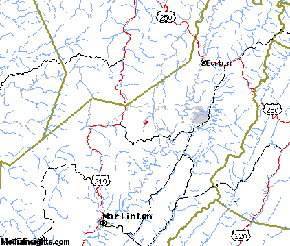
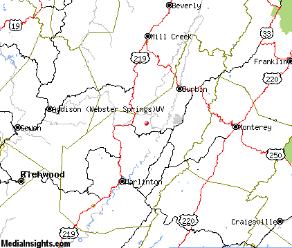
Surrounding areas: Slatyfork, West Virginia (3.5 mi), Cass, West Virginia (4.0 mi), Marlinton, West Virginia (15.2 mi), Hillsboro, West Virginia (23.6 mi), Rough Run, West Virginia (25.5 mi), Elkins, West Virginia (35.3 mi)
|

|
Snowshoe Vacation Rentals
|

|
|
|

|
Snowshoe Hotels and Resorts
|

|
|
| | | Hotels & Motels |
| Spruce Lodge | Snowshoe Dr | Snowshoe, WV | | (304) 572-2900 | | The Inn At Snowshoe | | Snowshoe, WV | | (304) 572-1000 | | Timberline Lodge | Snowshoe Dr | Snowshoe, WV | | (304) 572-2900 | | Whistle Punk Village & Inn | | Snowshoe, WV | | (304) 572-1000 | | Marlinton Motor Inn | Rt 219 N | Marlinton, WV | 15.2 mi. | (304) 799-4711 | | The Inn At Mountain Quest | RR 2 Box 109 | Marlinton, WV | 15.2 mi. | (304) 799-7267 | | Highland Inn | Main St | Monterey, VA | 21.6 mi. | (540) 468-2143 | | Valley View Motel | | Millcreek, WV | 21.6 mi. | (304) 335-6226 |

|
Snowshoe Weather & Climate
|

|
|
|
Northeastern West Virginia has a four-season, mountainous climate. Due to its high elevation, this region has a somewhat cooler, moister climate than surrounding areas at lower altitudes. Summers are mild and humid with high temperatures ranging from the 60s to low 70s F. Summer low temperatures average 50-55 F, although temperatures below freezing have been recorded in every month of the year. The elevation and geographic location allows it to receive significant upslope snow, particularly during prolonged periods of northwesterly winds coming off the Great Lakes. Located along the spine of the central Appalachian Mountains, this region is often near the southwestern extreme of Nor'easters, getting significant snowfall from strong, Atlantic moisture-laden, easterly winds. Annual snowfall averages 160 inches.
|
| Month |
High Temp |
Low Temp |
Rainfall |
Ocean Temp |
| January |
29°F |
13°F |
6.10 in. |
- |
| February |
32°F |
16°F |
4.91 in. |
- |
| March |
40°F |
23°F |
5.92 in. |
- |
| April |
50°F |
32°F |
4.38 in. |
- |
| May |
60°F |
44°F |
4.91 in. |
- |
| June |
67°F |
52°F |
5.14 in. |
- |
| July |
71°F |
56°F |
5.26 in. |
- |
| August |
70°F |
56°F |
4.69 in. |
- |
| September |
64°F |
50°F |
4.06 in. |
- |
| October |
53°F |
38°F |
3.90 in. |
- |
| November |
42°F |
28°F |
4.72 in. |
- |
| December |
34°F |
19°F |
5.66 in. |
- |

|
Snowshoe Map & Transportation
|

|
|
 |
|
|
| Click each thumbnail image to enlarge. |
 |
 |
 |
 |
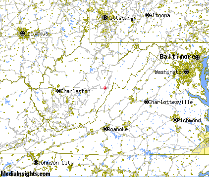
The closest airports in the area are the Greenbrier Valley airport (LWB) located about 45 miles southwest of Snowshoe in Lewisburg, West Virginia, the Shenandoah Valley Regional airport (SHD) located approximately 59 miles east of Snowshoe in Staunton / Waynesboro / Harrisonburg, Virginia, the Harrison Marion Regional airport (CKB) located roughly 61 miles north of Snowshoe in Clarksburg, West Virginia, and finally Roanoke Regional Woodrum Field (ROA) located around 75 miles south of Snowshoe in Roanoke, Virginia.
|

|
Snowshoe Attractions
|

|
|
| | | Golf Courses |
| Pocahontas Country Club | Marlinton | WV | 15.3 mi. | | | Mountain View Golf Course | Webster Springs | WV | 23.5 mi. | |
| | | Ski Areas |
| The Homestead | Hot Springs | VA | 30.4 mi. | | | Massanutten | Harrisonburg | VA | 60.1 mi. | | | Bryce Resort | Basye | VA | 69.4 mi. | | | Wintergreen Resort | Wintergreen | VA | 69.5 mi. | | | Winterplace | Flat Top | WV | 84.2 mi. | | | Wisp Ski Area | Mchenry | MD | 85.3 mi. | |
| | | State Parks |
| Cass Scenic Railroad State Park | | WV | 3.4 mi. | | | Watoga State Park | | WV | 24.2 mi. | | | Holly River State Park | | WV | 25.0 mi. | | | Droop Mountain Battlefield State Park | | WV | 26.8 mi. | | | Beartown State Park | | WV | 30.2 mi. | | | Douthat State Park | | VA | 38.1 mi. | |
| | | Zoos and Aquariums |
| Mill Mountain Zoo | Roanoke | VA | 79.7 mi. | | | National Zoo Conservation & Research Center | Front Royal | VA | 102.2 mi. | |
Notice a problem with the information on this page? Please notify us.
|
Disclaimer: We recommend you conduct your own research regarding all accomodations and attractions found on this website. The distances shown on this website are straight-line distances as the crow flies. The road distance may be considerably longer. You assume all liability for use of any information found on this website. No information is confirmed or warranted in any way. By using our services you agree to the terms and conditions of this disclaimer.
|
| We are the #1 site for your West Virginia Vacation presenting West Virginia vacation rentals, hotels, weather and map for each city. |
West Virginia Vacation .com
©1997-2025 All Rights Reserved.
|
|